


TYPHOON MAYSAK MAKES IT'S WAY TO KOREA
입력 2020.08.31 (15:52)
수정 2020.08.31 (16:46)
읽어주기 기능은 크롬기반의
브라우저에서만 사용하실 수 있습니다.


[Anchor Lead]
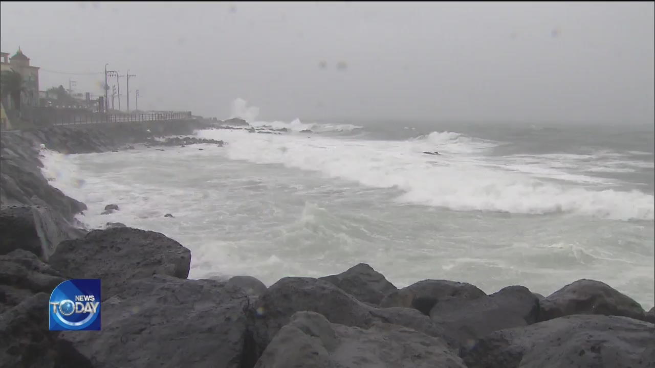
Another typhoon is coming our way. It looks like Typhoon Maysak is likely to make landfall on the southern coast of Korea in the early morning hours of September 3rd. This year's 9th typhoon, projected to be more powerful than Typhoon Bavi that swept through Korea recently, may bring extensive damages to the southern and eastern regions of the country.
[Pkg]
Maysak is expected to hit Korea in the middle of this week. Making its way up north from the southern seas of Okinawa, the year's ninth typhoon is likely to grow more powerful as it slowly passes over warm waters. The force of nature will speed up as it moves northward. Maysak will pass through the south of Okinawa this afternoon and move up as far as 200 kilometers off Seogwipo by Wednesday afternoon. It's projected to make landfall on the southern coast of Gyeongsangnam-do Province in the early morning hours of September 3rd. The typhoon will then make its way through the inland region of Yeongnam. For now, it seems Maysak is on course to make landfall in Korea. It could bring more devastation than Bavi which recently passed over the West Sea. Maysak is also likely to build up more strength than Bavi. It has already developed into a strong typhoon. By the time it reaches Jeju Island, Maysak is expected to keep its maximum wind speed and maintain a very strong system.
[Soundbite] U JIN-GYU(FORECAST ANALYSIS TEAM, KOREA METEOROLOGICAL ADMINISTRATION) : "Torrential rain is very likely as the typhoon will rapidly bring much steam to the area. Another likely scenario is strong winds causing severe damage."
While the entire country will be affected by Maysak, the southern coast, the southeastern and eastern regions on the typhoon's path are likely to suffer extensive damage, prompting the local governments to make thorough preparations. However, Maysak may still make course changes given such variables as the North Pacific High near the typhoon.
■ 제보하기
▷ 카카오톡 : 'KBS제보' 검색, 채널 추가
▷ 전화 : 02-781-1234, 4444
▷ 이메일 : kbs1234@kbs.co.kr
▷ 유튜브, 네이버, 카카오에서도 KBS뉴스를 구독해주세요!
- TYPHOON MAYSAK MAKES IT'S WAY TO KOREA
-
- 입력 2020-08-31 15:53:16
- 수정2020-08-31 16:46:27
[Anchor Lead]
Another typhoon is coming our way. It looks like Typhoon Maysak is likely to make landfall on the southern coast of Korea in the early morning hours of September 3rd. This year's 9th typhoon, projected to be more powerful than Typhoon Bavi that swept through Korea recently, may bring extensive damages to the southern and eastern regions of the country.
[Pkg]
Maysak is expected to hit Korea in the middle of this week. Making its way up north from the southern seas of Okinawa, the year's ninth typhoon is likely to grow more powerful as it slowly passes over warm waters. The force of nature will speed up as it moves northward. Maysak will pass through the south of Okinawa this afternoon and move up as far as 200 kilometers off Seogwipo by Wednesday afternoon. It's projected to make landfall on the southern coast of Gyeongsangnam-do Province in the early morning hours of September 3rd. The typhoon will then make its way through the inland region of Yeongnam. For now, it seems Maysak is on course to make landfall in Korea. It could bring more devastation than Bavi which recently passed over the West Sea. Maysak is also likely to build up more strength than Bavi. It has already developed into a strong typhoon. By the time it reaches Jeju Island, Maysak is expected to keep its maximum wind speed and maintain a very strong system.
[Soundbite] U JIN-GYU(FORECAST ANALYSIS TEAM, KOREA METEOROLOGICAL ADMINISTRATION) : "Torrential rain is very likely as the typhoon will rapidly bring much steam to the area. Another likely scenario is strong winds causing severe damage."
While the entire country will be affected by Maysak, the southern coast, the southeastern and eastern regions on the typhoon's path are likely to suffer extensive damage, prompting the local governments to make thorough preparations. However, Maysak may still make course changes given such variables as the North Pacific High near the typhoon.
이 기사가 좋으셨다면
-
좋아요
0
-
응원해요
0
-
후속 원해요
0
오늘의 핫 클릭
실시간 뜨거운 관심을 받고 있는 뉴스
헤드라인


이 기사에 대한 의견을 남겨주세요.