


[Anchor]
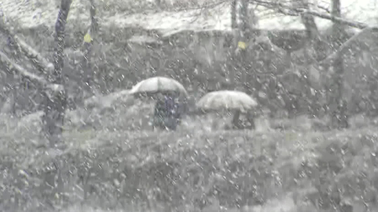
This Lunar New Year holiday, the weather is a bit concerning.
Frequent snow and rain are expected, along with a cold wave.
In the early part of the holiday, the east coast region is expected to see snow or rain, and next Monday, nationwide precipitation is anticipated.
Meteorological specialist Kim Min-kyung reports.
[Report]
During the six-day Lunar New Year holiday starting tomorrow (1.25), snow and rain will be frequent.
First, in the early part of the holiday, it will be the east coast region.
A cloud band developed over the East Sea is moving in, and by tomorrow, snow or rain will fall in the eastern coastal areas of Gangwon and Gyeongbuk.
The expected snowfall is up to 15 cm in the mountainous areas of Gangwon, and about 1 to 5 cm in the northeastern mountainous areas of Gangwon and Gyeongbuk.
Then, in the mid-holiday period next Monday (1.27), snow or rain is expected nationwide.
Starting from the west coast in the early hours of Monday, it will gradually expand across the country, and in the central region, there will be places where heavy snow warnings will be issued due to significant accumulation.
After the snow clouds pass, a strong wind and cold wave will move in.
On Tuesday (1.28) morning, the temperature in Seoul is expected to drop sharply to minus 4 degrees, which is 5 degrees lower than the previous day, and the entire country will experience sub-zero temperatures.
The Meteorological Administration predicts that there is a possibility of cold wave warnings being issued for inland areas.
[Kim Dong-soo/Meteorological Administration Forecast Analyst: "In particular, on Lunar New Year's Day, Wednesday which is Jan. 29, it is expected that the wind chill will make it feel even colder..."]
Cold air is expected to create snow clouds over the West Sea, leading to significant snowfall in the west coast region until Wednesday (1.29), which is Lunar New Year's Day.
Roads on the way to hometowns may become icy, so caution is needed for traffic safety.
Additionally, from the mid-holiday period, there is a high possibility of strong wind warnings being issued over the seas, so it is advisable to check the operation status in advance when using maritime routes.
This is KBS News, Kim Min-kyung.
■ 제보하기
▷ 카카오톡 : 'KBS제보' 검색, 채널 추가
▷ 전화 : 02-781-1234, 4444
▷ 이메일 : kbs1234@kbs.co.kr
▷ 유튜브, 네이버, 카카오에서도 KBS뉴스를 구독해주세요!
- Lunar New Year holiday weather
-
- 입력 2025-01-25 01:15:55
[Anchor]
This Lunar New Year holiday, the weather is a bit concerning.
Frequent snow and rain are expected, along with a cold wave.
In the early part of the holiday, the east coast region is expected to see snow or rain, and next Monday, nationwide precipitation is anticipated.
Meteorological specialist Kim Min-kyung reports.
[Report]
During the six-day Lunar New Year holiday starting tomorrow (1.25), snow and rain will be frequent.
First, in the early part of the holiday, it will be the east coast region.
A cloud band developed over the East Sea is moving in, and by tomorrow, snow or rain will fall in the eastern coastal areas of Gangwon and Gyeongbuk.
The expected snowfall is up to 15 cm in the mountainous areas of Gangwon, and about 1 to 5 cm in the northeastern mountainous areas of Gangwon and Gyeongbuk.
Then, in the mid-holiday period next Monday (1.27), snow or rain is expected nationwide.
Starting from the west coast in the early hours of Monday, it will gradually expand across the country, and in the central region, there will be places where heavy snow warnings will be issued due to significant accumulation.
After the snow clouds pass, a strong wind and cold wave will move in.
On Tuesday (1.28) morning, the temperature in Seoul is expected to drop sharply to minus 4 degrees, which is 5 degrees lower than the previous day, and the entire country will experience sub-zero temperatures.
The Meteorological Administration predicts that there is a possibility of cold wave warnings being issued for inland areas.
[Kim Dong-soo/Meteorological Administration Forecast Analyst: "In particular, on Lunar New Year's Day, Wednesday which is Jan. 29, it is expected that the wind chill will make it feel even colder..."]
Cold air is expected to create snow clouds over the West Sea, leading to significant snowfall in the west coast region until Wednesday (1.29), which is Lunar New Year's Day.
Roads on the way to hometowns may become icy, so caution is needed for traffic safety.
Additionally, from the mid-holiday period, there is a high possibility of strong wind warnings being issued over the seas, so it is advisable to check the operation status in advance when using maritime routes.
This is KBS News, Kim Min-kyung.
-
-

김민경 기자 minkyung@kbs.co.kr
김민경 기자의 기사 모음
-
이 기사가 좋으셨다면
-
좋아요
0
-
응원해요
0
-
후속 원해요
0
오늘의 핫 클릭
실시간 뜨거운 관심을 받고 있는 뉴스
헤드라인


이 기사에 대한 의견을 남겨주세요.