


[Anchor]
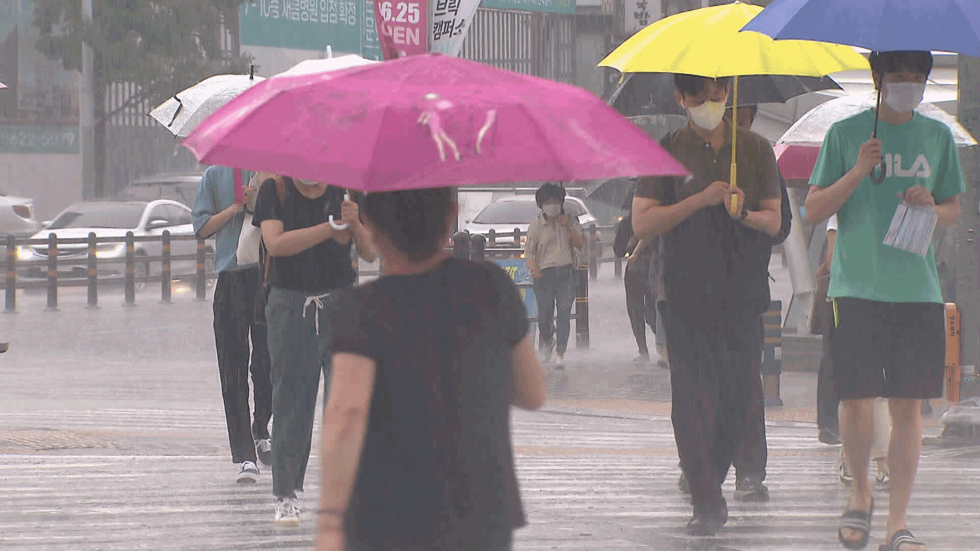
Throughout this week, there will be frequent rain, reminiscent of the monsoon season.
This is due to a stationary front forming in the southern part of the Korean Peninsula.
Until tomorrow (Aug. 12), the main impact will be on the southern regions, and from the day after tomorrow (Aug. 13), it is expected to affect the central regions as well.
Kim Min-kyung, our meteorological specialist, reports.
[Report]
Rain clouds stretching east to west from the South Sea to Japan.
This is a stationary front that is typically seen during the monsoon season.
Since this morning (Aug. 11), it has been slowly moving north from the South Sea.
As a result, today, the mountainous areas of Jeju received nearly 100mm of rain, while the southern coastal areas saw around 60mm of heavy rain.
In some areas, such as the mountainous regions of Jeju and Wando in Jeollanam-do, heavy rain of around 30mm per hour fell.
The Korea Meteorological Administration has forecasted an additional 20 to 80mm of rain for the coastal areas of Jeollanam-do and Gyeongsangnam-do by tomorrow.
[Nam Min-ji/Meteorological Administration Forecast Analyst: "Due to the influence of the stationary front, rain will fall in the southern regions and Jeju Island. In particular, additional rain is expected in the southern coast, which received a lot of rain last weekend, so please be cautious."]
The stationary front is expected to move northward to the central regions starting the day after tomorrow (Aug. 13).
The Korea Meteorological Administration predicts that on the day after tomorrow, Seoul, Incheon, and the inland areas of Gangwon Province will receive up to 80mm, and northern Gyeonggi Province will see more than 100mm of heavy rain.
Rain of up to 60mm is also forecasted for other parts of the country.
In particular, from the afternoon of the day after tomorrow, heavy rain of 30 to 50mm per hour is expected, especially in the metropolitan area.
The rain in the central regions will continue until the morning of Liberation Day on the 15th.
After that, a hot North Pacific high-pressure system will push the rain clouds away, leading to a decrease in rain but a return of the heat wave.
This is KBS News, Kim Min-kyung.
■ 제보하기
▷ 카카오톡 : 'KBS제보' 검색, 채널 추가
▷ 전화 : 02-781-1234, 4444
▷ 이메일 : kbs1234@kbs.co.kr
▷ 유튜브, 네이버, 카카오에서도 KBS뉴스를 구독해주세요!
- Frequent rain this week
-
- 입력 2025-08-12 00:05:11
[Anchor]
Throughout this week, there will be frequent rain, reminiscent of the monsoon season.
This is due to a stationary front forming in the southern part of the Korean Peninsula.
Until tomorrow (Aug. 12), the main impact will be on the southern regions, and from the day after tomorrow (Aug. 13), it is expected to affect the central regions as well.
Kim Min-kyung, our meteorological specialist, reports.
[Report]
Rain clouds stretching east to west from the South Sea to Japan.
This is a stationary front that is typically seen during the monsoon season.
Since this morning (Aug. 11), it has been slowly moving north from the South Sea.
As a result, today, the mountainous areas of Jeju received nearly 100mm of rain, while the southern coastal areas saw around 60mm of heavy rain.
In some areas, such as the mountainous regions of Jeju and Wando in Jeollanam-do, heavy rain of around 30mm per hour fell.
The Korea Meteorological Administration has forecasted an additional 20 to 80mm of rain for the coastal areas of Jeollanam-do and Gyeongsangnam-do by tomorrow.
[Nam Min-ji/Meteorological Administration Forecast Analyst: "Due to the influence of the stationary front, rain will fall in the southern regions and Jeju Island. In particular, additional rain is expected in the southern coast, which received a lot of rain last weekend, so please be cautious."]
The stationary front is expected to move northward to the central regions starting the day after tomorrow (Aug. 13).
The Korea Meteorological Administration predicts that on the day after tomorrow, Seoul, Incheon, and the inland areas of Gangwon Province will receive up to 80mm, and northern Gyeonggi Province will see more than 100mm of heavy rain.
Rain of up to 60mm is also forecasted for other parts of the country.
In particular, from the afternoon of the day after tomorrow, heavy rain of 30 to 50mm per hour is expected, especially in the metropolitan area.
The rain in the central regions will continue until the morning of Liberation Day on the 15th.
After that, a hot North Pacific high-pressure system will push the rain clouds away, leading to a decrease in rain but a return of the heat wave.
This is KBS News, Kim Min-kyung.
-
-

김민경 기자 minkyung@kbs.co.kr
김민경 기자의 기사 모음
-
이 기사가 좋으셨다면
-
좋아요
0
-
응원해요
0
-
후속 원해요
0
오늘의 핫 클릭
실시간 뜨거운 관심을 받고 있는 뉴스
헤드라인

![[단독] IMS모빌리티에 산업은행 100억 투자…‘김건희 집사’에게만 34억 원](/data/news/2025/08/12/20250812_xryL3D.jpg)
![[단독] 서희건설 회장, ‘목걸이 발견 뉴스’에 증거인멸…결국 ‘자수서’ 제출](/data/layer/904/2025/08/20250812_yKB1Ru.jpg)


이 기사에 대한 의견을 남겨주세요.