


GEOPARK DESTROYED OVER EARTHQUAKE
입력 2021.12.16 (15:20)
수정 2021.12.16 (16:46)
읽어주기 기능은 크롬기반의
브라우저에서만 사용하실 수 있습니다.

[Anchor Lead]
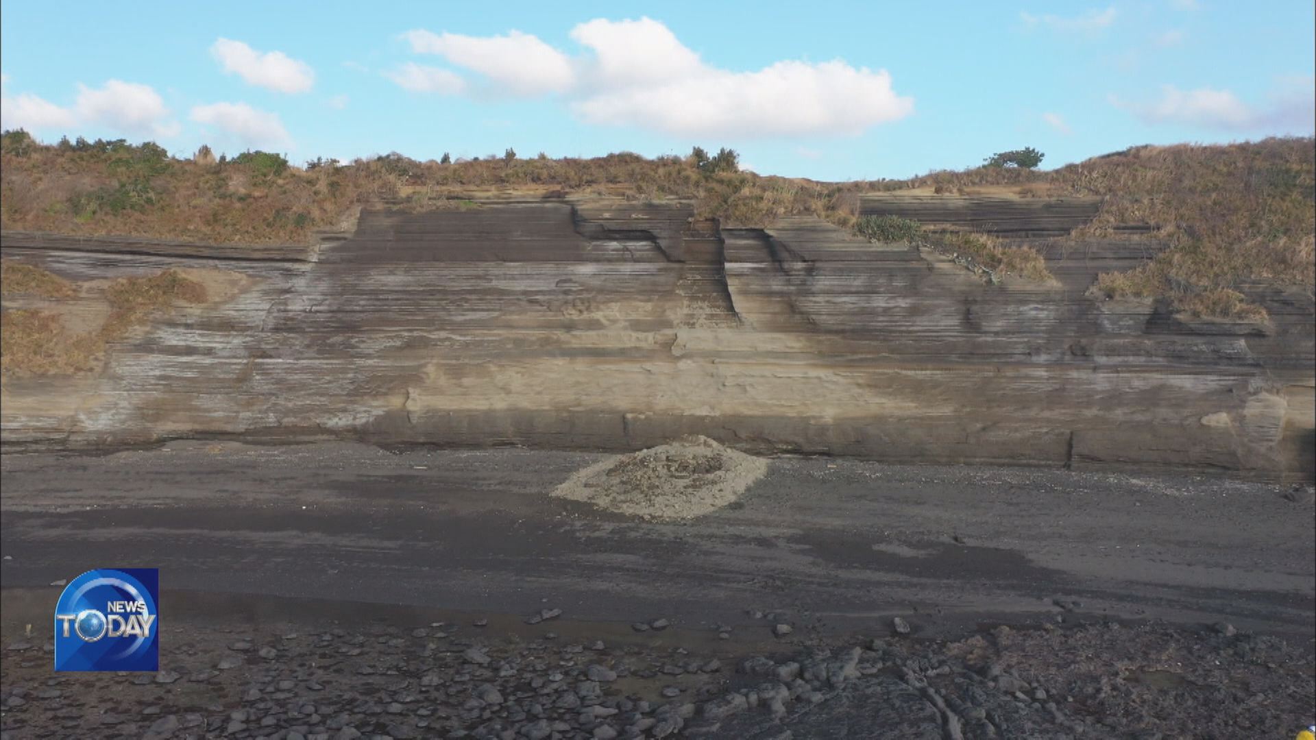
The magnitude-4.9 earthquake that struck Jejudo Island recently has destroyed a global geopark, which is also designated as a natural monument. The 20m lipid layer has partially collapsed.
[pkg]
Marado. Located on the southernmost tip of South Korean territory The footage of security cameras installed on the island and motorways shake violently. A magnitude-4.9 earthquake that struck off Marado has destroyed a 20m-tall volcanic debris layer on a coastal cliff. The collapsed part measures 28 cubic meters.
[Soundbite] Ko Hyung-jong(Jeju-do Island Government) : "This is apparently the result of the earthquake, because the damp and dry parts are easy to tell apart."
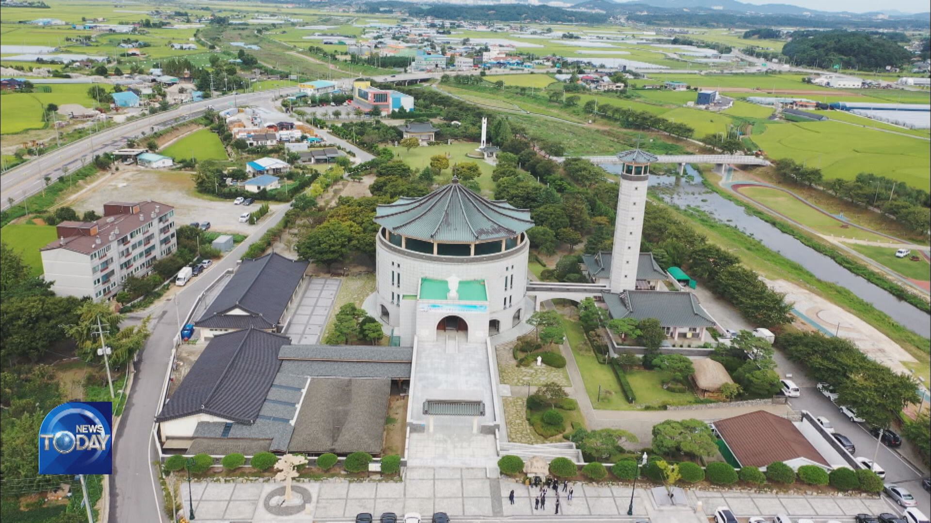
Since this area was designated by UNESCO as a global geopark in 2014, it has been visited by scores of hikers. Locals are devastated by the destruction of one of the island's top tourist attractions.
[Soundbite] Kang Young-hwan(Local Resident) : "When I came here in the morning after the earthquake, there were rocks on the ground. It looked dangerous. I hope authorities take safety measures."
Aftershocks still continue. More than 10 have been recorded. A magnitude-2.8 aftershock was recorded in the sea 40km off west-southwestern Jeju, the most powerful tremor since the quake. No serious damage from aftershocks has been reported so far. The Korea Authority of Land and Infrastructure Safety is working in an emergency regime following the earthquake. It's monitoring aftershocks and destruction in real time to prepare for additional tremors.
The magnitude-4.9 earthquake that struck Jejudo Island recently has destroyed a global geopark, which is also designated as a natural monument. The 20m lipid layer has partially collapsed.
[pkg]
Marado. Located on the southernmost tip of South Korean territory The footage of security cameras installed on the island and motorways shake violently. A magnitude-4.9 earthquake that struck off Marado has destroyed a 20m-tall volcanic debris layer on a coastal cliff. The collapsed part measures 28 cubic meters.
[Soundbite] Ko Hyung-jong(Jeju-do Island Government) : "This is apparently the result of the earthquake, because the damp and dry parts are easy to tell apart."
Since this area was designated by UNESCO as a global geopark in 2014, it has been visited by scores of hikers. Locals are devastated by the destruction of one of the island's top tourist attractions.
[Soundbite] Kang Young-hwan(Local Resident) : "When I came here in the morning after the earthquake, there were rocks on the ground. It looked dangerous. I hope authorities take safety measures."
Aftershocks still continue. More than 10 have been recorded. A magnitude-2.8 aftershock was recorded in the sea 40km off west-southwestern Jeju, the most powerful tremor since the quake. No serious damage from aftershocks has been reported so far. The Korea Authority of Land and Infrastructure Safety is working in an emergency regime following the earthquake. It's monitoring aftershocks and destruction in real time to prepare for additional tremors.
■ 제보하기
▷ 카카오톡 : 'KBS제보' 검색, 채널 추가
▷ 전화 : 02-781-1234, 4444
▷ 이메일 : kbs1234@kbs.co.kr
▷ 유튜브, 네이버, 카카오에서도 KBS뉴스를 구독해주세요!
- GEOPARK DESTROYED OVER EARTHQUAKE
-
- 입력 2021-12-16 15:20:41
- 수정2021-12-16 16:46:05
[Anchor Lead]
The magnitude-4.9 earthquake that struck Jejudo Island recently has destroyed a global geopark, which is also designated as a natural monument. The 20m lipid layer has partially collapsed.
[pkg]
Marado. Located on the southernmost tip of South Korean territory The footage of security cameras installed on the island and motorways shake violently. A magnitude-4.9 earthquake that struck off Marado has destroyed a 20m-tall volcanic debris layer on a coastal cliff. The collapsed part measures 28 cubic meters.
[Soundbite] Ko Hyung-jong(Jeju-do Island Government) : "This is apparently the result of the earthquake, because the damp and dry parts are easy to tell apart."
Since this area was designated by UNESCO as a global geopark in 2014, it has been visited by scores of hikers. Locals are devastated by the destruction of one of the island's top tourist attractions.
[Soundbite] Kang Young-hwan(Local Resident) : "When I came here in the morning after the earthquake, there were rocks on the ground. It looked dangerous. I hope authorities take safety measures."
Aftershocks still continue. More than 10 have been recorded. A magnitude-2.8 aftershock was recorded in the sea 40km off west-southwestern Jeju, the most powerful tremor since the quake. No serious damage from aftershocks has been reported so far. The Korea Authority of Land and Infrastructure Safety is working in an emergency regime following the earthquake. It's monitoring aftershocks and destruction in real time to prepare for additional tremors.
이 기사가 좋으셨다면
-
좋아요
0
-
응원해요
0
-
후속 원해요
0
오늘의 핫 클릭
실시간 뜨거운 관심을 받고 있는 뉴스
헤드라인

![[단독] 내란 특검, 오늘 오후 박종준 전 경호처장·이주호 교육부 장관 소환](/data/news/2025/07/04/20250704_84OJ6P.jpg)


이 기사에 대한 의견을 남겨주세요.