Seoul sees heaviest November snowfall in 117 years
입력 2024.11.28 (00:12)
읽어주기 기능은 크롬기반의
브라우저에서만 사용하실 수 있습니다.
[Anchor]
Today, Seoul experienced the heaviest snowfall ever recorded in November.
This marks a record-breaking snowfall in 117 years, and forecasts indicate that more snow will fall by tomorrow.
For details on this historic snowfall, we turn to meteorologist Kim Se-hyun.
[Report]
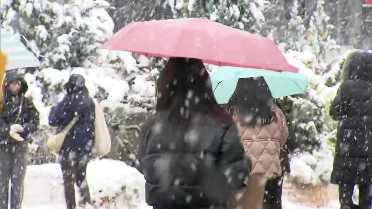
As of 3 PM today, the snow accumulation in Seoul reached 17.2cm.
This is the largest snowfall recorded in a single day in November since weather observations began in 1907, marking 117 years.
A 'heavy snow warning' was issued for the metropolitan area, the first such warning for the city of Seoul in 14 years since 2010.
The weather had been mild until mid-November, but it has taken a drastic turn with cold waves and heavy snowfall in the latter half of the month.
This unusual heavy snowfall is attributed to a 'blocking' phenomenon causing extreme weather globally.
A low-pressure system passing north of our country was blocked by a high-pressure system to the east, allowing cold air below minus 30 degrees Celsius to flow into the Korean Peninsula at an altitude of 5km.
As this cold air passed over the relatively warmer West Sea, which is about 2 degrees warmer than usual, atmospheric instability increased, leading to the strong development of snow clouds that brought significant snowfall to the metropolitan area driven by strong westerly winds.
The 'blocking' phenomenon is known for sustaining severe weather conditions, and similar heavy snowfall is forecasted overnight.
[Kim Young-jun/Korea Meteorological Administration: "A band of snow clouds developed along the upper-level low-pressure flow is expected to move in tonight into early tomorrow, bringing significant snowfall."]
By tomorrow, southern Gyeonggi Province is expected to receive more than 25cm of snow, while parts of Chungcheong Province could see over 15cm, and Seoul is forecasted to receive more than 10cm of additional snow.
With around 25cm of snow already fallen, there are concerns about potential collapse damage from the additional snowfall.
Additionally, temperatures in most areas are expected to drop below freezing tomorrow morning, leading to continued icy road conditions.
This is KBS News, Kim Se-hyun reporting.
■ 제보하기
▷ 카카오톡 : 'KBS제보' 검색, 채널 추가
▷ 전화 : 02-781-1234, 4444
▷ 이메일 : kbs1234@kbs.co.kr
▷ 유튜브, 네이버, 카카오에서도 KBS뉴스를 구독해주세요!
- Seoul sees heaviest November snowfall in 117 years
-
- 입력 2024-11-28 00:12:42

[Anchor]
Today, Seoul experienced the heaviest snowfall ever recorded in November.
This marks a record-breaking snowfall in 117 years, and forecasts indicate that more snow will fall by tomorrow.
For details on this historic snowfall, we turn to meteorologist Kim Se-hyun.
[Report]
As of 3 PM today, the snow accumulation in Seoul reached 17.2cm.
This is the largest snowfall recorded in a single day in November since weather observations began in 1907, marking 117 years.
A 'heavy snow warning' was issued for the metropolitan area, the first such warning for the city of Seoul in 14 years since 2010.
The weather had been mild until mid-November, but it has taken a drastic turn with cold waves and heavy snowfall in the latter half of the month.
This unusual heavy snowfall is attributed to a 'blocking' phenomenon causing extreme weather globally.
A low-pressure system passing north of our country was blocked by a high-pressure system to the east, allowing cold air below minus 30 degrees Celsius to flow into the Korean Peninsula at an altitude of 5km.
As this cold air passed over the relatively warmer West Sea, which is about 2 degrees warmer than usual, atmospheric instability increased, leading to the strong development of snow clouds that brought significant snowfall to the metropolitan area driven by strong westerly winds.
The 'blocking' phenomenon is known for sustaining severe weather conditions, and similar heavy snowfall is forecasted overnight.
[Kim Young-jun/Korea Meteorological Administration: "A band of snow clouds developed along the upper-level low-pressure flow is expected to move in tonight into early tomorrow, bringing significant snowfall."]
By tomorrow, southern Gyeonggi Province is expected to receive more than 25cm of snow, while parts of Chungcheong Province could see over 15cm, and Seoul is forecasted to receive more than 10cm of additional snow.
With around 25cm of snow already fallen, there are concerns about potential collapse damage from the additional snowfall.
Additionally, temperatures in most areas are expected to drop below freezing tomorrow morning, leading to continued icy road conditions.
This is KBS News, Kim Se-hyun reporting.
Today, Seoul experienced the heaviest snowfall ever recorded in November.
This marks a record-breaking snowfall in 117 years, and forecasts indicate that more snow will fall by tomorrow.
For details on this historic snowfall, we turn to meteorologist Kim Se-hyun.
[Report]
As of 3 PM today, the snow accumulation in Seoul reached 17.2cm.
This is the largest snowfall recorded in a single day in November since weather observations began in 1907, marking 117 years.
A 'heavy snow warning' was issued for the metropolitan area, the first such warning for the city of Seoul in 14 years since 2010.
The weather had been mild until mid-November, but it has taken a drastic turn with cold waves and heavy snowfall in the latter half of the month.
This unusual heavy snowfall is attributed to a 'blocking' phenomenon causing extreme weather globally.
A low-pressure system passing north of our country was blocked by a high-pressure system to the east, allowing cold air below minus 30 degrees Celsius to flow into the Korean Peninsula at an altitude of 5km.
As this cold air passed over the relatively warmer West Sea, which is about 2 degrees warmer than usual, atmospheric instability increased, leading to the strong development of snow clouds that brought significant snowfall to the metropolitan area driven by strong westerly winds.
The 'blocking' phenomenon is known for sustaining severe weather conditions, and similar heavy snowfall is forecasted overnight.
[Kim Young-jun/Korea Meteorological Administration: "A band of snow clouds developed along the upper-level low-pressure flow is expected to move in tonight into early tomorrow, bringing significant snowfall."]
By tomorrow, southern Gyeonggi Province is expected to receive more than 25cm of snow, while parts of Chungcheong Province could see over 15cm, and Seoul is forecasted to receive more than 10cm of additional snow.
With around 25cm of snow already fallen, there are concerns about potential collapse damage from the additional snowfall.
Additionally, temperatures in most areas are expected to drop below freezing tomorrow morning, leading to continued icy road conditions.
This is KBS News, Kim Se-hyun reporting.
-
-

김세현 기자 weather@kbs.co.kr
김세현 기자의 기사 모음
-
이 기사가 좋으셨다면
-
좋아요
0
-
응원해요
0
-
후속 원해요
0


이 기사에 대한 의견을 남겨주세요.