


[Anchor]
Record-breaking heavy rain has continued for the third day.
As reported, heavy rain is forecasted again tonight (July 18).
Meteorologist Kim Min-kyung looked into how long this heavy rainfall will last.
[Report]
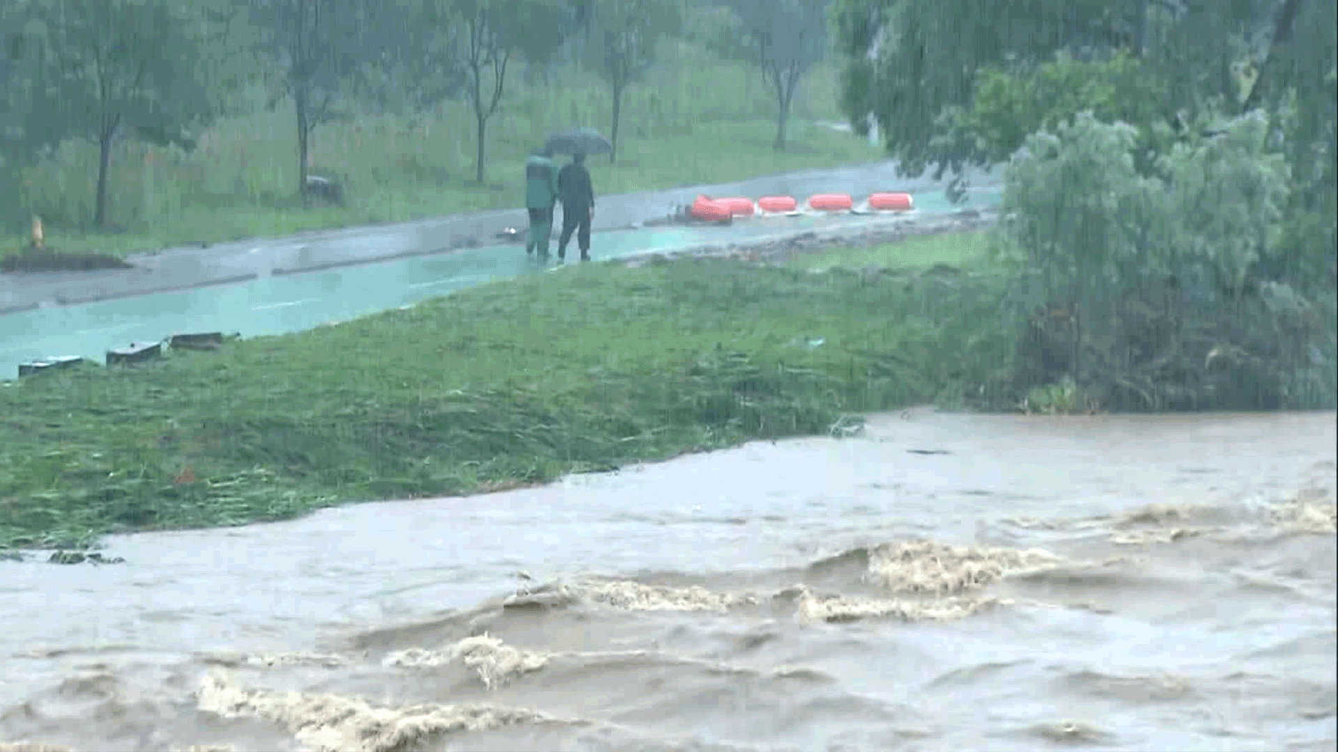
This is the CCTV footage from Naju Bridge over the Yeongsan River.
The muddy river water is flowing fiercely.
The water levels at Yongsan Bridge and Wongomak Bridge have also started to rise again.
A flood warning is currently in effect for these areas.
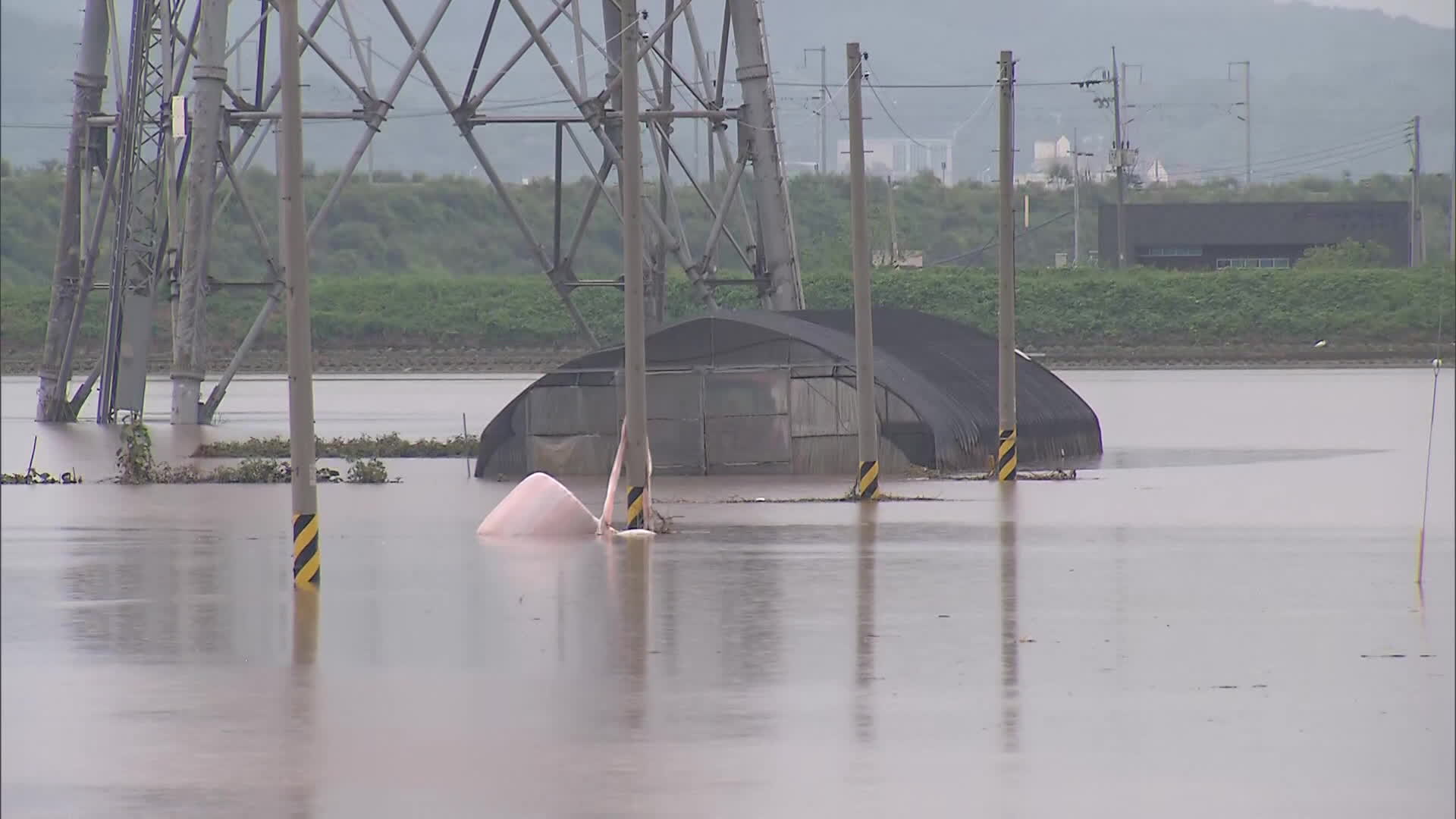
This is because the amount of rain that usually falls in a month during the monsoon season has already fallen in just three days.
In the Seosan area, which recorded 519mm of rainfall over three days, this far exceeds the average monthly rainfall for the monsoon season.
In other areas, more than one-third of the annual rainfall has concentrated in just three days.
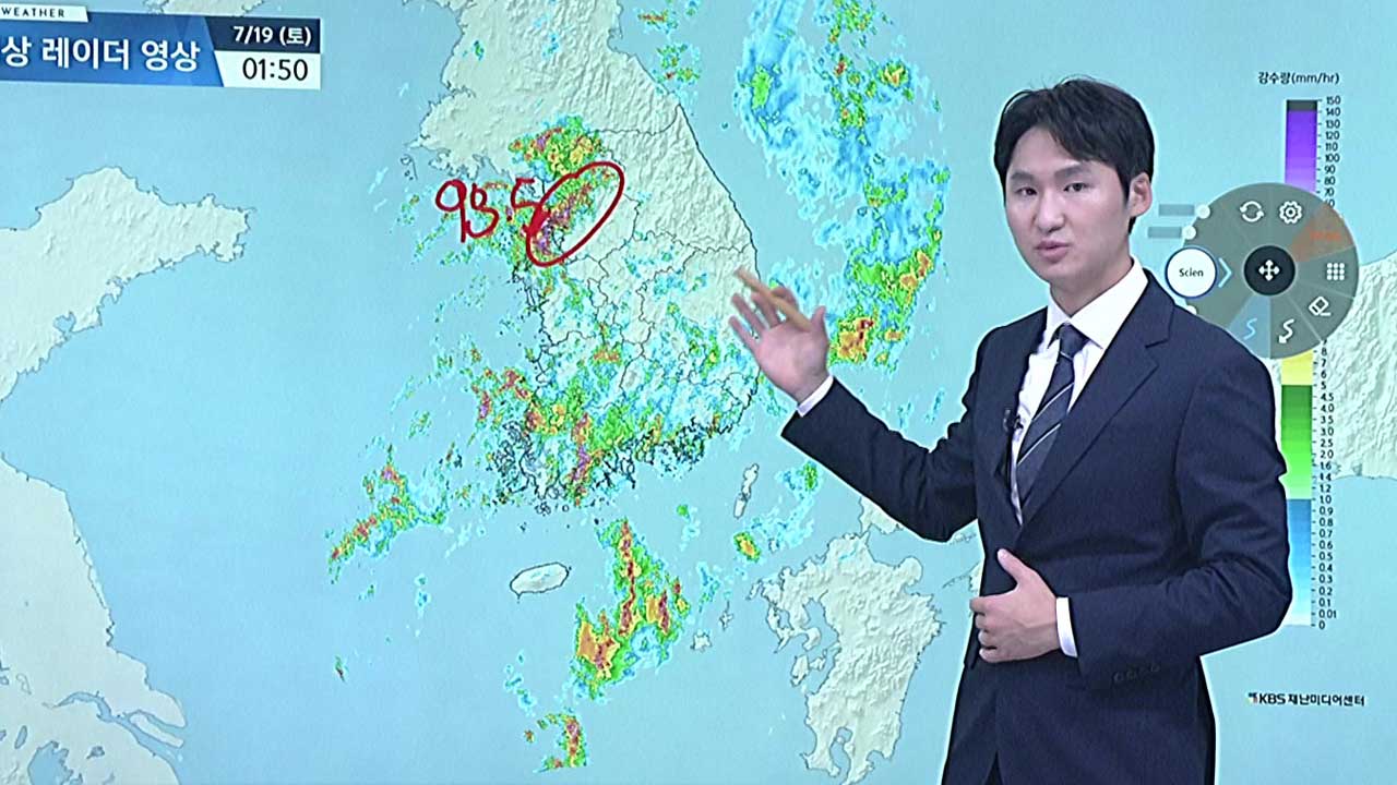
This record-breaking heavy rain is expected to return tonight and continue until tomorrow morning (July 19).
The center of the strong rain clouds will move up and down over South Jeolla and North Gyeongsang provinces, passing through the southern regions.
In South Chungcheon Province and the southern regions, extreme rainfall of up to 80mm per hour is expected.
In various parts of the central region, strong rain of around 30mm per hour will also occur.
[Kim Byeong-kwon/Meteorological Administration Forecast Analyst: "Very strong rain will fall in the southern regions, such as the southern coast where tropical moisture directly hits the terrain, and in the central region where moisture meets cold air, so please be cautious."]
By tomorrow, up to 400mm of rain is expected in South Jeolla Province, up to 300mm in South Gyeongsang Province, and up to 200mm in other southern and Chungcheong regions.
The rain clouds that brought heavy rain will be pushed northward as the North Pacific high pressure expands.
The Meteorological Administration predicts that the rain will gradually stop starting from the southern regions tomorrow night, while some areas in the central region may continue to see rain until the morning of the day after tomorrow (July 20).
This is KBS News Kim Min-kyung.
Record-breaking heavy rain has continued for the third day.
As reported, heavy rain is forecasted again tonight (July 18).
Meteorologist Kim Min-kyung looked into how long this heavy rainfall will last.
[Report]
This is the CCTV footage from Naju Bridge over the Yeongsan River.
The muddy river water is flowing fiercely.
The water levels at Yongsan Bridge and Wongomak Bridge have also started to rise again.
A flood warning is currently in effect for these areas.
This is because the amount of rain that usually falls in a month during the monsoon season has already fallen in just three days.
In the Seosan area, which recorded 519mm of rainfall over three days, this far exceeds the average monthly rainfall for the monsoon season.
In other areas, more than one-third of the annual rainfall has concentrated in just three days.
This record-breaking heavy rain is expected to return tonight and continue until tomorrow morning (July 19).
The center of the strong rain clouds will move up and down over South Jeolla and North Gyeongsang provinces, passing through the southern regions.
In South Chungcheon Province and the southern regions, extreme rainfall of up to 80mm per hour is expected.
In various parts of the central region, strong rain of around 30mm per hour will also occur.
[Kim Byeong-kwon/Meteorological Administration Forecast Analyst: "Very strong rain will fall in the southern regions, such as the southern coast where tropical moisture directly hits the terrain, and in the central region where moisture meets cold air, so please be cautious."]
By tomorrow, up to 400mm of rain is expected in South Jeolla Province, up to 300mm in South Gyeongsang Province, and up to 200mm in other southern and Chungcheong regions.
The rain clouds that brought heavy rain will be pushed northward as the North Pacific high pressure expands.
The Meteorological Administration predicts that the rain will gradually stop starting from the southern regions tomorrow night, while some areas in the central region may continue to see rain until the morning of the day after tomorrow (July 20).
This is KBS News Kim Min-kyung.
■ 제보하기
▷ 카카오톡 : 'KBS제보' 검색, 채널 추가
▷ 전화 : 02-781-1234, 4444
▷ 이메일 : kbs1234@kbs.co.kr
▷ 유튜브, 네이버, 카카오에서도 KBS뉴스를 구독해주세요!
- Record rain continues
-
- 입력 2025-07-19 00:05:16
[Anchor]
Record-breaking heavy rain has continued for the third day.
As reported, heavy rain is forecasted again tonight (July 18).
Meteorologist Kim Min-kyung looked into how long this heavy rainfall will last.
[Report]
This is the CCTV footage from Naju Bridge over the Yeongsan River.
The muddy river water is flowing fiercely.
The water levels at Yongsan Bridge and Wongomak Bridge have also started to rise again.
A flood warning is currently in effect for these areas.
This is because the amount of rain that usually falls in a month during the monsoon season has already fallen in just three days.
In the Seosan area, which recorded 519mm of rainfall over three days, this far exceeds the average monthly rainfall for the monsoon season.
In other areas, more than one-third of the annual rainfall has concentrated in just three days.
This record-breaking heavy rain is expected to return tonight and continue until tomorrow morning (July 19).
The center of the strong rain clouds will move up and down over South Jeolla and North Gyeongsang provinces, passing through the southern regions.
In South Chungcheon Province and the southern regions, extreme rainfall of up to 80mm per hour is expected.
In various parts of the central region, strong rain of around 30mm per hour will also occur.
[Kim Byeong-kwon/Meteorological Administration Forecast Analyst: "Very strong rain will fall in the southern regions, such as the southern coast where tropical moisture directly hits the terrain, and in the central region where moisture meets cold air, so please be cautious."]
By tomorrow, up to 400mm of rain is expected in South Jeolla Province, up to 300mm in South Gyeongsang Province, and up to 200mm in other southern and Chungcheong regions.
The rain clouds that brought heavy rain will be pushed northward as the North Pacific high pressure expands.
The Meteorological Administration predicts that the rain will gradually stop starting from the southern regions tomorrow night, while some areas in the central region may continue to see rain until the morning of the day after tomorrow (July 20).
This is KBS News Kim Min-kyung.
-
-

김민경 기자 minkyung@kbs.co.kr
김민경 기자의 기사 모음
-
이 기사가 좋으셨다면
-
좋아요
0
-
응원해요
0
-
후속 원해요
0
오늘의 핫 클릭
실시간 뜨거운 관심을 받고 있는 뉴스


이 기사에 대한 의견을 남겨주세요.